topografía del aire
topografía del aire
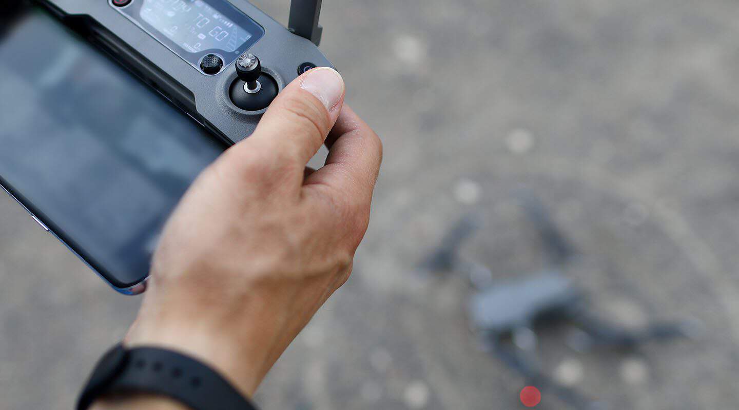
Servicios profesionales de levantamiento topográfico, cartografía y mapeo aéreo con tecnología de drones de última generación en todo el Caribe.
Ofrecemos una gama completa de servicios con drones para satisfacer las necesidades de topografía, inspección y mapeo de su proyecto.
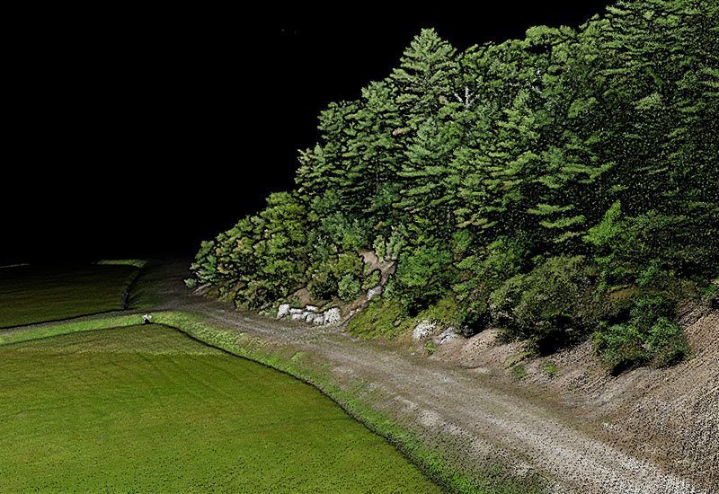
Levantamientos topográficos de alta precisión con tecnología LiDAR y fotogrametría para proyectos de construcción e ingeniería.
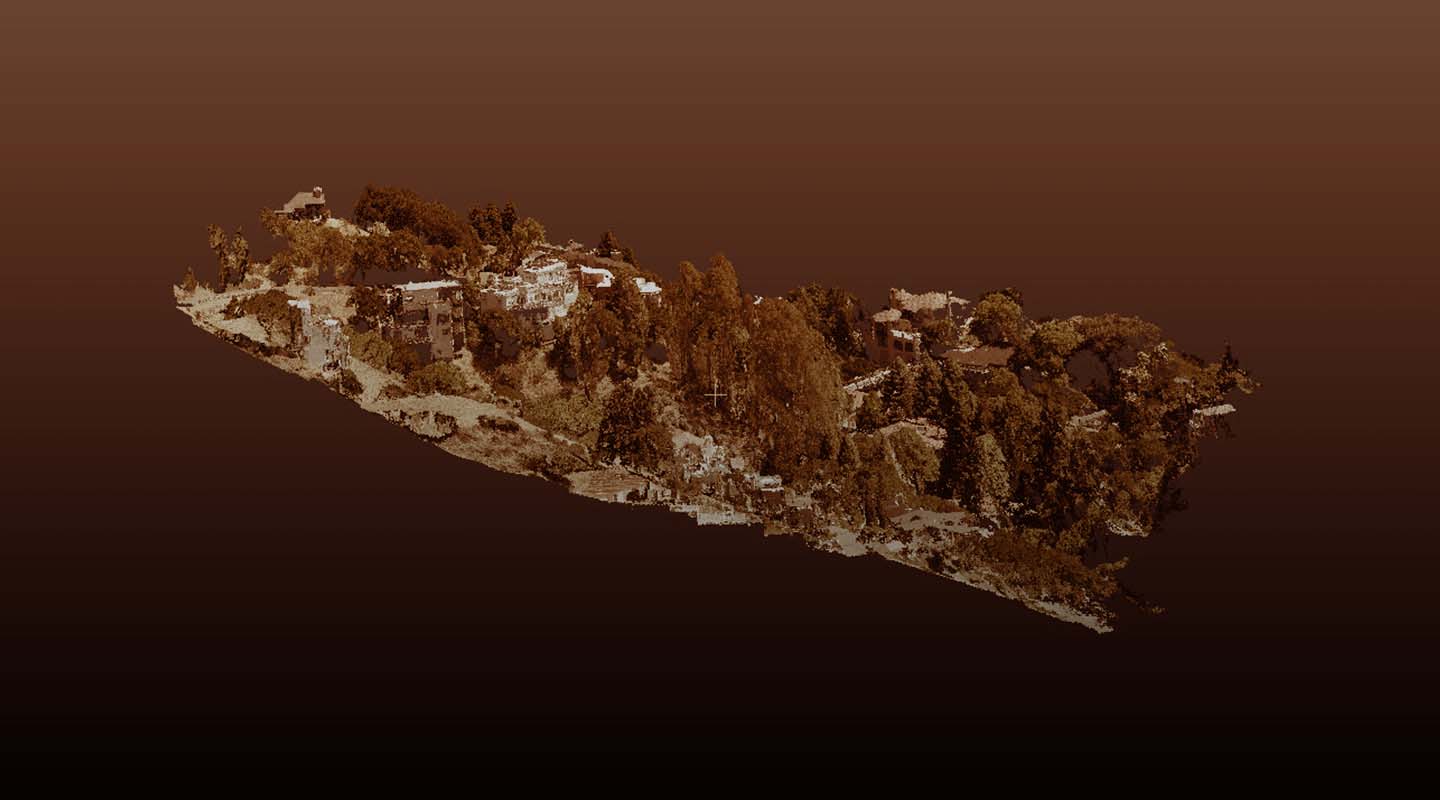
Generación de mapas ortomosaicos, modelos digitales de elevación (DEM) y cartografía detallada para planificación territorial.
Monitoreo del avance de obra, inspección de infraestructuras y seguimiento de proyectos de construcción en tiempo real.
Análisis multiespectral de cultivos, detección de plagas, mapeo de índice NDVI y optimización del riego agrícola.
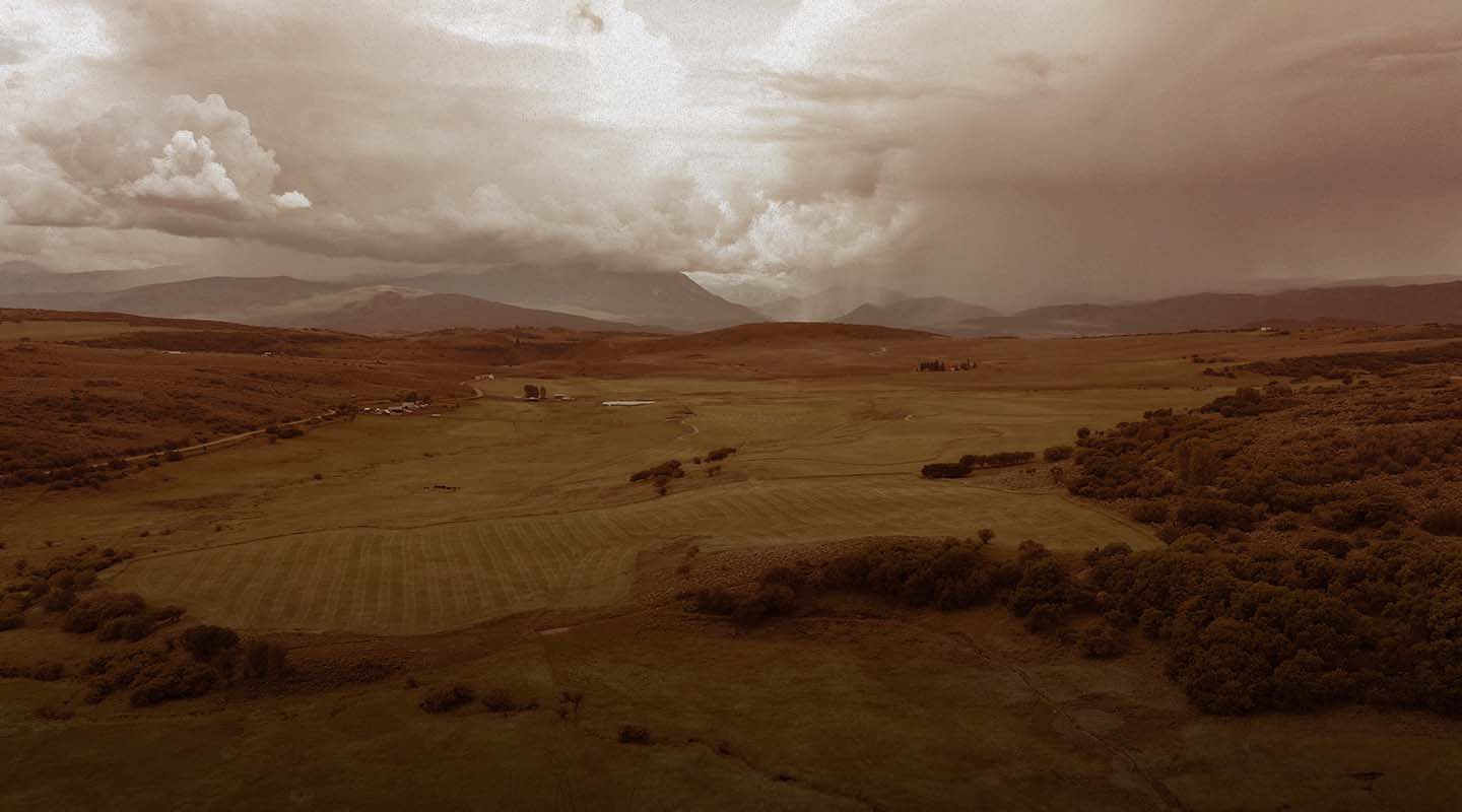
Contenido audiovisual profesional en 4K/8K para proyectos inmobiliarios, turismo, eventos y marketing corporativo.
Inspección termográfica de paneles solares, líneas de transmisión eléctrica y torres de telecomunicaciones.
Vibok Air es una empresa dominicana especializada en servicios de topografía y cartografía aérea, con sede en Punta Cana. Desde nuestra fundación, hemos revolucionado la forma en que se realizan los levantamientos topográficos en la República Dominicana y el Caribe.
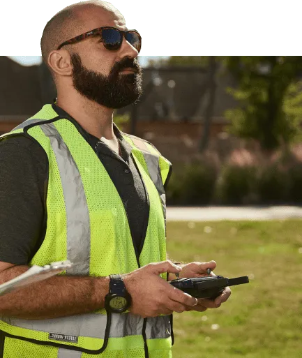
Nuestro equipo de pilotos certificados e ingenieros topógrafos combina la experiencia técnica con la tecnología de drones más avanzada para ofrecer resultados de precisión milimétrica.
Operadores autorizados por el IDAC con licencia vigente
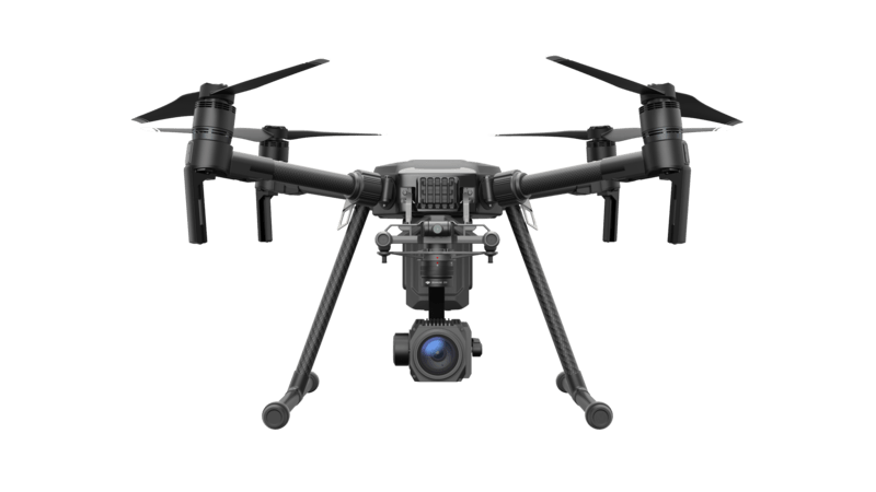
Equipos DJI Enterprise de última generación con sensores LiDAR y RTK
Cobertura de seguros completa y protocolos de seguridad estrictos
Nuestros servicios de drones se adaptan a las necesidades específicas de cada sector, entregando resultados que transforman la manera de trabajar.
Levantamientos topográficos con precisión RTK centimétrica, modelos digitales del terreno y curvas de nivel para ingeniería civil.
Monitoreo de avance de obra, volumetrías, comparativas temporales y modelos 3D para proyectos de construcción.
Análisis multiespectral NDVI, mapeo de cultivos, detección de estrés hídrico y optimización del riego agrícola.
Inspección termográfica de paneles solares, líneas de transmisión, torres de telecomunicaciones y plantas industriales.
Video aéreo 4K/8K, tours virtuales 360°, fotografía inmobiliaria y contenido para marketing de lujo.
Volumetrías de excavación, mapeo ambiental, estudios de impacto y monitoreo de recursos naturales con LiDAR.
Explora algunos de nuestros trabajos más destacados en topografía, cartografía y mapeo aéreo.
Un enfoque profesional y sistemático para garantizar resultados de la más alta calidad.
Analizamos sus necesidades, definimos el alcance del proyecto y preparamos una propuesta personalizada con cronograma y presupuesto.
Diseñamos el plan de vuelo óptimo, verificamos el espacio aéreo, obtenemos permisos necesarios y establecemos puntos de control en tierra (GCP).
Ejecutamos las misiones de vuelo con protocolos de seguridad estrictos, capturando datos con la más alta resolución y precisión.
Procesamos los datos capturados con software especializado para generar ortomosaicos, nubes de puntos, modelos 3D y productos cartográficos.
Entregamos informes técnicos completos, archivos digitales en todos los formatos requeridos y soporte post-entrega para sus consultas.
Utilizamos la tecnología más avanzada del mercado para garantizar resultados excepcionales.
Drone enterprise de nueva generación con LiDAR rotativo, radar mmWave y evasión de obstáculos 360° para misiones BVLOS.
Sensor LiDAR de última generación para mapeo 3D de alta densidad, ideal para terrenos con vegetación.
Sensor CMOS 4/3 de 20MP con cámara zoom 56x y módulo RTK para fotogrametría de alta resolución.
Pix4D, Agisoft Metashape, DJI Terra, Global Mapper y AutoCAD Civil 3D para procesamiento profesional.
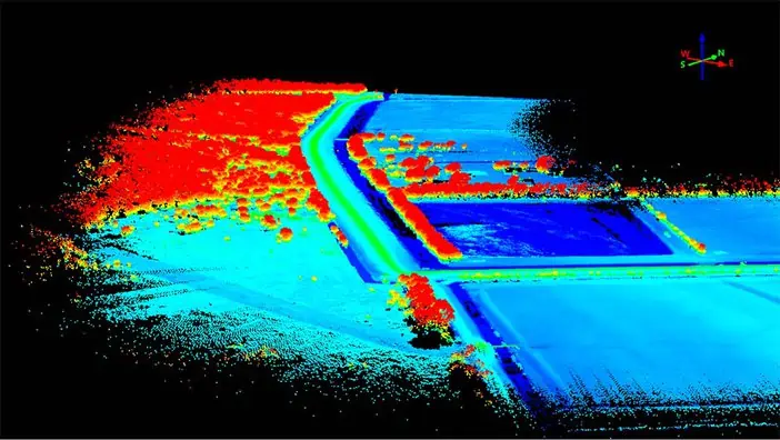
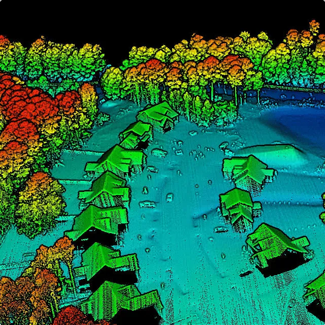
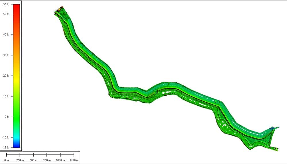
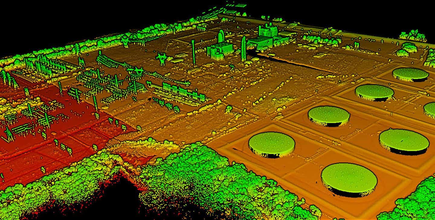
Nuestra tecnología LiDAR (Light Detection and Ranging) captura millones de puntos por segundo, creando modelos 3D ultra-precisos incluso a través de vegetación densa.
El sensor DJI Zenmuse L2 captura hasta 240,000 puntos por segundo con 5 retornos simultáneos
Precisión absoluta centimétrica con sistema RTK integrado y puntos de control en tierra (GCP)
Penetra vegetación densa capturando el terreno real debajo de árboles y maleza
Modelos tridimensionales detallados exportables a AutoCAD, ArcGIS y cualquier software GIS
Nube de Puntos
Modelo de Elevación
Combinamos ambas tecnologías para obtener los mejores resultados: LiDAR para precisión + fotogrametría para visualización.
Utilice nuestra calculadora interactiva para obtener un estimado del costo de su proyecto. Los precios finales pueden variar según la complejidad.
~ USD $680
*Estimado aproximado. El precio final se confirma tras evaluación del sitio.
Solicitar Cotización ExactaSoluciones adaptadas a cada necesidad. Todos los precios incluyen vuelo, procesamiento y entrega de resultados.
Con base en Punta Cana, cubrimos todo el territorio nacional y el Caribe. Nuestro equipo se desplaza a cualquier ubicación.
Sí, contamos con todos los permisos del Instituto Dominicano de Aviación Civil (IDAC). Gestionamos los permisos de vuelo necesarios para cada proyecto, incluyendo espacio aéreo controlado y zonas restringidas cuando aplica.
Con nuestro sistema RTK y puntos de control en tierra (GCP), alcanzamos una precisión horizontal de ±2cm y vertical de ±3cm. Con LiDAR, la precisión vertical puede llegar a ±1cm bajo condiciones óptimas.
Un proyecto de hasta 5 hectáreas se completa en 3-5 días hábiles (vuelo + procesamiento). Proyectos más grandes pueden tomar 1-2 semanas. Ofrecemos servicio express con cargo adicional para entregas en 24-48 horas.
Entregamos en múltiples formatos según sus necesidades: GeoTIFF, DWG, DXF, SHP, KML, LAS/LAZ (nube de puntos), OBJ/FBX (modelos 3D), PDF (informes). Compatibles con AutoCAD, ArcGIS, QGIS, Google Earth y más.
La seguridad es nuestra prioridad. Si las condiciones meteorológicas no son favorables (vientos >30 km/h, lluvia), reprogramamos el vuelo sin costo adicional. Monitoreamos el clima 48 horas antes de cada operación.
Sí, contamos con seguro de responsabilidad civil para todas nuestras operaciones, cubriendo daños a terceros y equipos. Nuestros pilotos están certificados y mantienen licencias vigentes del IDAC.
Sí, con los permisos adecuados. Gestionamos autorizaciones especiales del IDAC para operaciones en zonas urbanas. Nuestros drones enterprise cuentan con sistemas redundantes de seguridad y tecnología anti-colisión.
Sí, ofrecemos planes de monitoreo recurrente (semanal, quincenal, mensual) para seguimiento de obras, agricultura y medio ambiente. Incluye comparativas temporales y reportes de avance con descuentos especiales.
Nuestro trabajo ha ayudado a empresas en toda la República Dominicana a optimizar sus proyectos, reducir costos y tomar mejores decisiones.
Obtenga una cotización gratuita en menos de 24 horas. Nuestro equipo está listo para ayudarle.
Complete el formulario o contáctenos directamente. Respondemos en menos de 24 horas.